DGCA drone rules and no-fly zones near Indian airports explained in simple Indian English. Read more for key zones, permits, and safety rules.
DGCA drone rules continue to shape how drones can be used near Indian airports, with strict no-fly zones and permission-based areas designed to keep air travel safe. The rules matter for passengers, airlines, drone users, and airport security because even a small drone can create a major risk if it enters controlled airspace.
Background
India formalised its current drone framework through the Drone Rules, 2021, which replaced the earlier UAS Rules and brought a simpler but stricter structure for registration, licensing, and airspace control. The rules also created the Digital Sky platform and airspace mapping system so users can check where drones can fly before take-off.
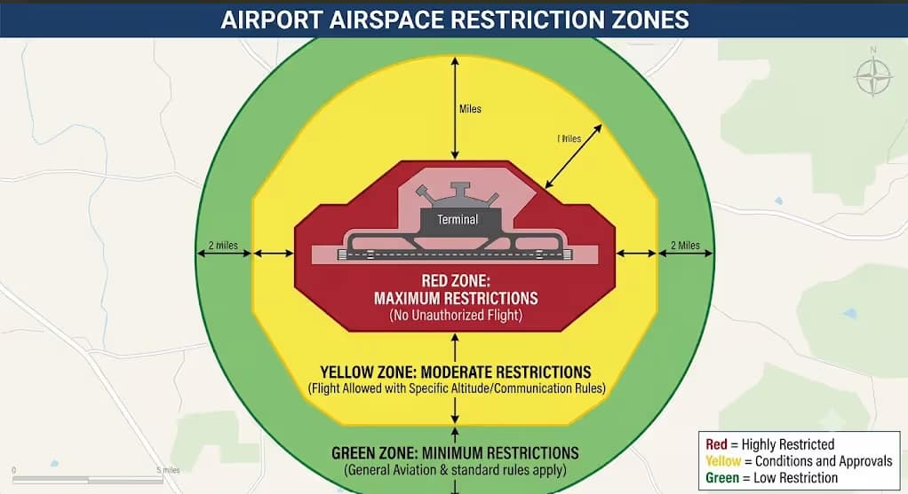
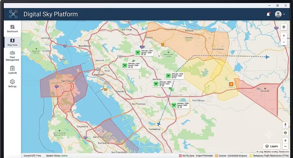
The key change for airport safety is the zone system around operational airports. Government replies and the official DGCA airspace map show that India’s drone airspace is split into green, yellow, and red zones, with airport-related restrictions built into the map.
Key rules near airports
DGCA drone rules and airport zones
ALSO READ: JetBlue Drone Collision at JFK Raises Safety Questions
- Red zone: Drone flights are allowed only with Central Government permission, and airport premises and restricted areas fall under tight control. The rule text says no person shall operate a drone in a red zone without prior permission.
- Yellow zone: Drone operations are restricted and need permission from the concerned air traffic control authority. The rules also say the airspace above 400 feet in green zones, and above 200 feet in the 8 km to 12 km airport belt, is part of the yellow zone.
- Green zone: No prior permission is required in a green zone, subject to checking the Digital Sky platform before flight. The rules define green zone as airspace up to 400 feet or 120 metres, outside red and yellow zones, with a special limit of 200 feet or 60 metres in the 8 km to 12 km airport belt.
- Dynamic map: The airspace map can change over time, so pilots must verify restrictions before every flight. The Digital Sky map also states that the airspace map is dynamic in nature.
What happens near airports
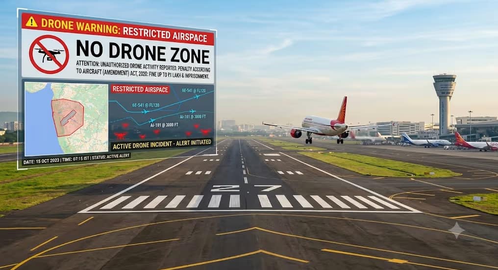
Official parliamentary information says the area up to 5 km from the perimeter of an airport is a red zone, while the area from 5 km to 8 km is an inner yellow zone, and the 8 km to 12 km band is an outer yellow zone above specified height limits. That means drone users cannot treat the airport area as a simple circle; altitude also matters.
The Drone Rules, 2021 also say temporary red zones can be declared for up to 96 hours in urgent cases by the State Government, Union Territory Administration, or law enforcement agency. This is important because temporary restrictions can come up suddenly around sensitive locations, including airport-adjacent areas.
Impact on passengers and industry
For common passengers, these rules reduce the risk of drone interference with aircraft during take-off and landing. A drone sighting near an airport can force delays, diversions, or safety checks, so the no-fly zone framework protects both flight schedules and passenger safety.
For airlines and airport operators, the rules support safer runway operations and better incident prevention. For drone businesses, the rules mean more planning, more map checks, and more discipline before flying near urban areas, logistics routes, or airport corridors.
For Indian companies using drones in delivery, surveying, and security, compliance is now part of daily operations. The law also says penalties can go up to one lakh rupees for rule violations, which makes compliance a business requirement, not just a technical formality.
Safety features and compliance
The 2021 rules made registration mandatory for most drones and required the Digital Sky platform to verify zone restrictions before flight. They also introduced online systems for type certification, unique identification numbers, and remote pilot certification, while the 2022 amendment replaced the term “remote pilot licence” with “remote pilot certificate” in several places. Drone-Amendment-Rules.
The law also includes safety measures such as geo-fencing, real-time tracking beacons, and No Permission-No Takeoff features as future or notified safety tools. In simple words, these tools help drones stay within approved airspace and make them easier to track.
Expert view and data points
Official DGCA-linked material says the airspace map was published on the Digital Sky platform on 24 September 2021, and it clearly divides Indian airspace into red, yellow, and green zones. Another government reply stated that no approval is required in green zones, while red and yellow zones need permission based on the rule set.digitalsky.aai+1
Some media reports noted that the fee structure was reduced sharply under the 2021 framework, and the remote pilot licence fee was cut to a nominal amount across categories. The exact operational impact varies by drone class, but the policy direction is clear: simpler paperwork, stricter safety control near airports.
What’s next
The key next step for users is to keep checking the Digital Sky map before every flight, because zone status can change. The rules allow updates to the airspace map, and those changes can take effect after seven days from the date of update.
For the industry, the likely future focus is on better automation, stronger geo-fencing, and more drone traffic management tools, especially as commercial drone use grows around logistics, infrastructure, agriculture, and security. The rules already allow the government to publish a policy framework for unmanned aircraft system traffic management, which points to more advanced drone integration ahead.
Conclusion
DGCA drone rules have made Indian airport airspace much safer by creating clear no-fly and restricted zones, especially around operational airports. For drone users, the message is simple: check the zone, seek permission where needed, and never assume a flight is allowed just because it looks open on the map.